The Remote Sensing Toolbox
|
|
Welcome to the Remote Sensing page! The world is a fascinating place, especially when viewed in false colours from space.
We hope that you find the links and tools on this page useful.
Follow the links below:
Landsat 7 ETM radiometric characteristics
Some useful band combinations
How to acquire Landsat images
Where to get free software
Internet References
|
|
|
Band Number
|
Ground Resolution
|
Spectral Range (Microns)
|
Electromagnetic Region
|
Example Applications
|
|
1
|
30
|
0.450 - 0.515
|
Visible Blue
|
Differentiating vegetation from soils. Coastal water mapping.
|
|
2
|
30
|
0.525 - 0.605
|
Visible Green
|
Assessing vegetation vigour.
|
|
3
|
30
|
0.630 - 0.690
|
Visible Red
|
Vegetation classification using variations in Chlorophyll absorption.
|
|
4
|
30
|
0.775 - 0.900
|
Near Infrared
|
Biomass surveys. Delineating water bodies.
|
|
5
|
30
|
1.550 - 1.750
|
Middle Infrared
|
Vegetation/soil moisture measurements. Differentiating between clouds and snow.
|
|
6*
|
60
|
10.40 - 12.50
|
Thermal Infrared
|
Thermal mapping. Soil moisture studies. Vegetation heat stress measurements. Delineating faults.
|
|
7
|
30
|
2.090 - 2.350
|
Middle Infrared
|
Hydrothermal mapping.
|
|
8
|
15
|
0.520 - 0.900 (panchromatic)
|
Green, Visible Red, Near Infrared
|
Urban studies.
Adding resolution to satellite images.
|
|
* Band 6 is delivered as two bands (6a and 6b - high and low gains)
|
|
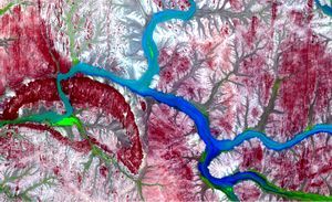
Some Useful Band Combinations
|
|
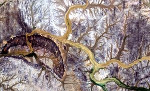
True Colour Composite (3-2-1)
|
|
|
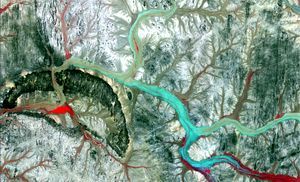
Near Infrared Composite (4-3-2)
|
|
|
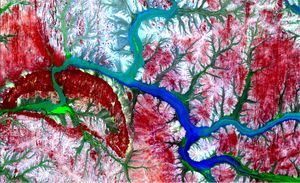
Short-wave Infrared Composite (7-4-2 or 7-4-3)
|
|
|
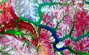
Vegetation classification (7-4-1)
|
|
|
Vegetation classification (5-4-3)
|
|
|
|
|
|
Where to acquire Landsat Images
|
|
Landsat
imagery from
Landinfo
|
|
EarthExplorer
|
|
USGS
|
|
|
|
Free Image Processing Software
|
|
ERDAS ViewFinder is a free viewing tool that has basic image viewing and manipulation capabilities.
Geomedia Viewer can load raster images and easily manipulate the images using its zoom-in, zoom-out capability.
MICRODEM can manipulate satellite imagery, digital elevation data, scanned maps, vector map data and database files.
MultiSpec is a processing system for interactively analyzing Earth observational multispectral image data such as that produced by the Landsat series of Earth satellites and hyperspectral image data from current and future airborne and spaceborne systems such as AVIRIS.
|
|
Some Internet References
|
|
|
|
|
|